Collaborators
BB Cutts (NC State), RE Emanuel (NC State), KL Martin (NC State), KM Suttles (USFS), JM Vose (USFS), DN Wear (USFS), JW Coulston (USFS)
Timeline
2017-2019
Project Goal
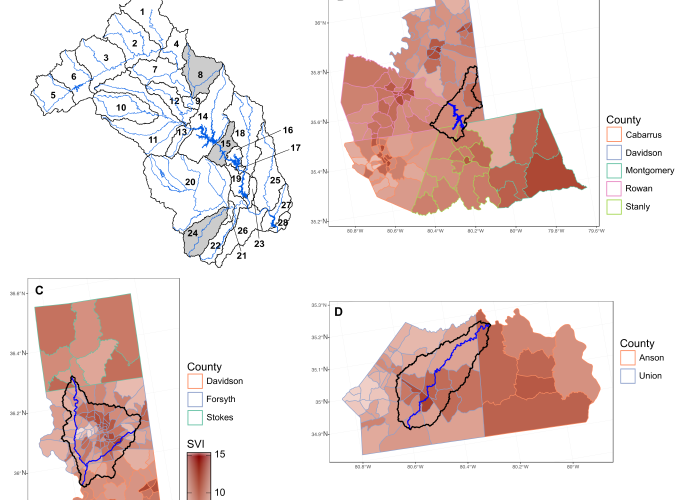
The goal of this project is to combine past and future hydrology model (i.e., Soil and Water Assessment Tool (SWAT)) outputs with demographics data to create maps and prioritize climate change adaptation planning for especially vulnerable communities in western North Carolina’s Yadkin-Pee Dee River Watershed.
Project Links
- GitHub Repository for Suttles et al. 2018
- GitHub Repository for Saia et al. 2019
- USFS SRS Compass Live Article
Acknowledgements
Special thanks to the Oak Ridge Institute for Science and Education for support this work.